PROJECT OBJECTIVES
This project serves as a five year review and update of the state wide rare species planning level survey which started in 1998. The sites were searched for the presence/absence of selected rare species and birds. Habitats were also assessed.
THEORETICAL BACKGROUND AND PROJECT RATIONALE
From 2014 through 2016, the NJARNG Environmental Management Bureau (EMB), in cooperation with Rowan University (Rowan), conducted a rare species planning level survey (PLS) at 21 NJARNG installations throughout the State. The PLS included Phase I habitat assessments and limited Phase II presence/absence surveys for selected rare mammals and birds. This survey serves as the five year review and update of the statewide PLS started in 1998. The Rowan interns queried these sites to find a list of potential rare species that could live in each specific sites ecosystem. Aerial maps of site habitats were created using Arcmap to help interns and DMAVA staff become familiar with the area and potential species. The interns did a lot of background research on each facilities habitat before actually going out to the field for site visits. During site visits the interns used ecosystem evaluations, visual surveys, broadcast surveys, and various wildlife acoustic digital recorders to collect data on the present rare species. The groups of rare species that were targeted during these surveys include bobcats, birds, bats, plants, mollusks, amphibians, and reptiles. Bird data was achieved by using Cornell's Ebird, which allows the anybody to post bird sightings online at different locations for the use of the general public. The interns gained knowledge on wildlife species management and species data collection. Weather data was also collected during site visits and official documents on native habitats and species were reviewed and used, such as the Information for Planning and Consulting (IPAC) documents and National Heritage documents. This real-life field experience gave the students a hands on project that required them to physically collect data from sites using different strategies, rather than just using data collected from anther source.
NJDMAVA's SUEIP intern group has since taken over responsibility for completing this project. SUEIP is currently in the works of putting together all of the data collected, creating more maps, and publishing a final rare species document.
DELIVERABLES
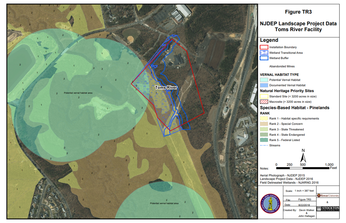
Figure TR3 above is an example of landscape data for the Toms River Armory. The purpose of this map is to visualize present vernal habitats and the ranks of possible species that could inhabit the area.
|
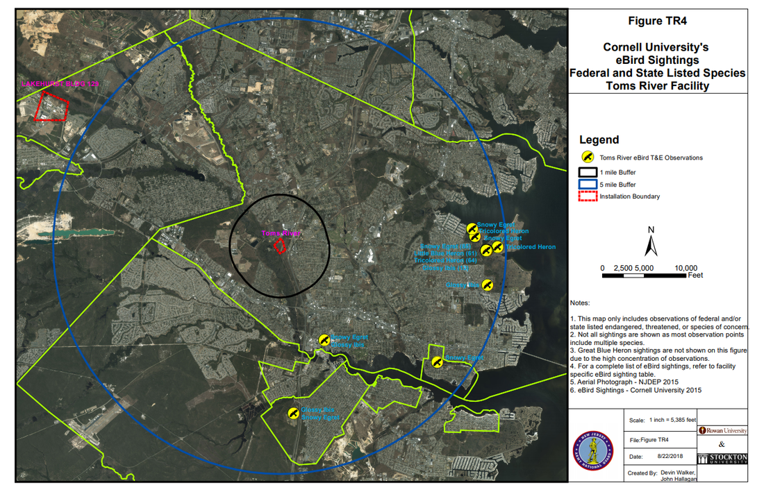
Figure TR4 above represents Cornell's Ebird observation data. Interns made 1 mile and 5 mile buffers around the site location to determine the bird proximity.
|
BENEFITS TO SUEIP INTERNS
Through this project, interns received:
Through this project, interns received:
- Experience with rare mammals and birds
- Experience creating aerial maps using Arcmap
- Experience with habitat research and using wildlife acoustic recorders
PHOTOS & VIDEOS OF OUR TEAM MEMBERS
PHOTOS & VIDEOS OF OUR TEAM MEMBERS
